Home > Europe > France > Canton > Landes
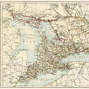
1855 U.S. Coast Survey Chart Or Map Of The Savanna River

![]()
Wall Art and Photo Gifts from Universal Images Group (UIG)
1855 U.S. Coast Survey Chart Or Map Of The Savanna River
1855, U.S. Coast Survey Chart or Map of the Savanna River, Georgia
Universal Images Group (UIG) manages distribution for many leading specialist agencies worldwide
Media ID 38549176
© Artokoloro Quint Lox Limited
1855 Georgia Antique Map Latitude Longitude Mappa Mundi Old Antique Plan Old Antique View Ols Antique Map Rare Old Maps Topo
FEATURES IN THESE COLLECTIONS
> Asia
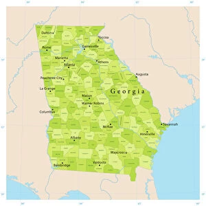
> Georgia
> Related Images
> Europe
> France
> Canton
> Landes
> Historic
> Space exploration
> Maps and Charts
> Early Maps
> Maps and Charts
> Related Images
> Maps and Charts
> World
> Universal Images Group (UIG)
> History
> Historical Maps
EDITORS COMMENTS
Step back in time to the mid-19th century with this stunning 1855 U.S. Coast Survey Chart of the Savannah River, Georgia. This vintage map is a treasure trove of geographical and historical significance, offering a glimpse into the region's topography and navigation routes during a pivotal era in American history.
The chart, created by the United States Coast Survey, provides an intricate illustration of the Savannah River's winding course, complete with detailed notations on latitude and longitude coordinates. The map also features numerous landmarks, including settlements, roads, and natural features such as islands and shoals.
This beautifully aged print is a testament to the cartographic skills of its creators and serves as a fascinating piece of geographic history. It would be an excellent addition to any collection or display dedicated to exploration, travel, or regional studies.
Whether you're an historian, geography enthusiast, or simply someone who appreciates vintage maps and prints, this rare find is sure to captivate your imagination. So why not take a journey through time and explore the wonders of this historic chart?
MADE IN THE USA
Safe Shipping with 30 Day Money Back Guarantee
FREE PERSONALISATION*
We are proud to offer a range of customisation features including Personalised Captions, Color Filters and Picture Zoom Tools
SECURE PAYMENTS
We happily accept a wide range of payment options so you can pay for the things you need in the way that is most convenient for you
* Options may vary by product and licensing agreement. Zoomed Pictures can be adjusted in the Cart.