Home > Europe > France > Canton > Landes
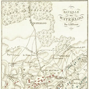
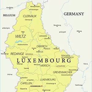
1827 Finley Map Of Belgium And Luxembourg Anthony Finley Mapmaker Of The United States In The 19th Century

![]()
Wall Art and Photo Gifts from Universal Images Group (UIG)
1827 Finley Map Of Belgium And Luxembourg Anthony Finley Mapmaker Of The United States In The 19th Century
1827, Finley Map of Belgium and Luxembourg, Anthony Finley mapmaker of the United States in the 19th century
Universal Images Group (UIG) manages distribution for many leading specialist agencies worldwide
Media ID 38550792
© Artokoloro Quint Lox Limited
1827 Antique Map Latitude Longitude Mappa Mundi Old Antique Plan Old Antique View Ols Antique Map Rare Old Maps Topo
FEATURES IN THESE COLLECTIONS
> Europe
> Belgium
> Related Images
> Europe
> France
> Canton
> Landes
> Europe
> Luxembourg
> Maps
> Europe
> Luxembourg
> Related Images
> Historic
> Space exploration
> Maps and Charts
> Early Maps
> Maps and Charts
> Luxembourg
> Maps and Charts
> Related Images
> Universal Images Group (UIG)
> History
> Historical Maps
EDITORS COMMENTS
Step back in time to the early 19th century with this stunning print of Anthony Finley's 1827 map of Belgium and Luxembourg. As a renowned American cartographer, Finley was known for his meticulous attention to detail and dedication to accuracy. This vintage map is a testament to his skill, showcasing the region's topography, geography, and landmarks with remarkable precision.
The intricate illustration features a grid layout, complete with latitude and longitude markings, allowing explorers and travelers to navigate the area with ease. The map also includes illustrations of notable cities, rivers, and mountains, providing a glimpse into the region's natural beauty.
This rare antique map is not only a beautiful piece of art but also a valuable resource for historians and enthusiasts alike. It offers a unique perspective on the evolution of cartography during the 19th century and serves as a reminder of humanity's enduring fascination with exploration and discovery.
Printed on high-quality paper, this vintage map is sure to be treasured by anyone who appreciates history, geography, or simply beautiful illustrations. Its aged appearance adds an air of nostalgia and sophistication to any room it adorns.
MADE IN THE USA
Safe Shipping with 30 Day Money Back Guarantee
FREE PERSONALISATION*
We are proud to offer a range of customisation features including Personalised Captions, Color Filters and Picture Zoom Tools
SECURE PAYMENTS
We happily accept a wide range of payment options so you can pay for the things you need in the way that is most convenient for you
* Options may vary by product and licensing agreement. Zoomed Pictures can be adjusted in the Cart.