Home > Europe > France > Canton > Landes
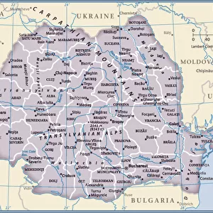
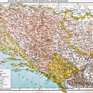
1770 Janvier Map Of Hungary Romania Transylvania

![]()
Wall Art and Photo Gifts from Universal Images Group (UIG)
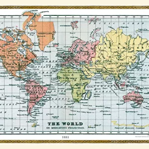
1770 Janvier Map Of Hungary Romania Transylvania
1770, Janvier Map of Hungary, Romania, Transylvania, Moldova, Croatia and Bosnia
Universal Images Group (UIG) manages distribution for many leading specialist agencies worldwide
Media ID 38548101
© Artokoloro Quint Lox Limited
1770 Moldova Romania Transylvania Antique Map Latitude Longitude Mappa Mundi Old Antique Plan Old Antique View Ols Antique Map Rare Old Maps Topo
FEATURES IN THESE COLLECTIONS
> Europe
> Bosnia and Herzegovina
> Maps
> Europe
> Croatia
> Related Images
> Europe
> France
> Canton
> Landes
> Europe
> Hungary
> Related Images
> Europe
> Moldova
> Related Images
> Europe
> Romania
> Related Images
> Universal Images Group (UIG)
> History
> Historical Maps
EDITORS COMMENTS
Step back in time to the 18th century with this stunning print of the Janvier Map of Hungary, Romania, Transylvania, Moldova, Croatia and Bosnia from 1770. This beautifully illustrated map is a treasure trove of geographical information and artistic flair. Created by French cartographer Jean-Baptiste Bourguignon d'Anville's student, Joseph Janvier, this map showcases the region's diverse landscapes, cities, and territories.
The intricate details on this vintage map reveal a wealth of information about the region's topography, including mountains ranges, rivers, forests, and settlements. The ornate borders and decorative illustrations add an air of elegance to the map's design.
This historic document not only provides valuable insights into the geography of Eastern Europe during the 18th century but also serves as a testament to human ingenuity and innovation in cartography. Whether you're a history buff or simply appreciate beautiful artistry on paper, this print is sure to captivate your imagination.
Hang it proudly in your home or office as a unique conversation piece that will transport you back in time to an era when exploration was at its peak.
MADE IN THE USA
Safe Shipping with 30 Day Money Back Guarantee
FREE PERSONALISATION*
We are proud to offer a range of customisation features including Personalised Captions, Color Filters and Picture Zoom Tools
SECURE PAYMENTS
We happily accept a wide range of payment options so you can pay for the things you need in the way that is most convenient for you
* Options may vary by product and licensing agreement. Zoomed Pictures can be adjusted in the Cart.