Fraud Blocker Skip to main content

Home > Maps and Charts > Netherlands

Netherlands Collection (#4)

Netherlands is a country located in Western Europe, bordered by Germany to the east and Belgium to the south

549 Items

Background imageNetherlands Collection: Map of Avesnes, c.1710. Creator: Anon

Map of Avesnes, c.1710. Creator: Anon
Map of Avesnes, c.1710

Background imageNetherlands Collection: Map of Sint-Omaars, 1650-1700. Creator: Anon

Map of Sint-Omaars, 1650-1700. Creator: Anon
Map of Sint-Omaars, 1650-1700

Background imageNetherlands Collection: Longwy fortress map, 1686. Creator: Anon

Longwy fortress map, 1686. Creator: Anon
Longwy fortress map, 1686

Background imageNetherlands Collection: Map of the south coast of South Africa between Cape Agulhas and the Sundays River, after 1789-1790

Map of the south coast of South Africa between Cape Agulhas and the Sundays River, after 1789-1790

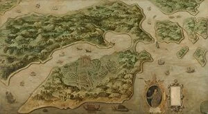
Background imageNetherlands Collection: View of Ambon, c.1617. Creator: Anon

View of Ambon, c.1617. Creator: Anon
View of Ambon, c.1617. Other Title(s): Bird's-eye View of Ambon, with a Portrait of Frederik Houtman (1571-1627) in a Cartouche

Background imageNetherlands Collection: Amsterdam as the Centre of World Trade, c.1604-c.1607. Creator: Pieter Isaacsz

Amsterdam as the Centre of World Trade, c.1604-c.1607. Creator: Pieter Isaacsz
Amsterdam as the Centre of World Trade, c.1604-c.1607. Other Title(s): Painting on a harpsichord lid with an Allegory of Amsterdam as the center of world trade

Background imageNetherlands Collection: Young Man in a Study, 1640-1650. Creator: Adriaen van Gaesbeeck

Young Man in a Study, 1640-1650. Creator: Adriaen van Gaesbeeck
Young Man in a Study, 1640-1650

Background imageNetherlands Collection: Conquest of Banda by the English on August 9, 1810, (1811). Creator: M. Graham

Conquest of Banda by the English on August 9, 1810, (1811). Creator: M. Graham
Conquest of Banda by the English on August 9, 1810, (1811). lllustrative account of Captain Cole's splendid achievement in the capture of the island of Banda

Background imageNetherlands Collection: Jonkheer Theodorus Frederik van Capellen (1762-1824), Vice Admiral, 1817

Jonkheer Theodorus Frederik van Capellen (1762-1824), Vice Admiral, 1817. Creator: Cornelis van Cuylenburg
Jonkheer Theodorus Frederik van Capellen (1762-1824), Vice Admiral, 1817

Background imageNetherlands Collection: Johan Boudaen Courten (1635-1716), Lord of St Laurens, Schellach and Popkensburg, 1668

Johan Boudaen Courten (1635-1716), Lord of St Laurens, Schellach and Popkensburg, 1668
Johan Boudaen Courten (1635-1716), Lord of St Laurens, Schellach and Popkensburg. Councillor of Middelburg and Director of the East India Company, 1668

Background imageNetherlands Collection: Map of the Holy Land Divided into the Twelve Tribes of Israel, 1580s. Creator: Adrichem

Map of the Holy Land Divided into the Twelve Tribes of Israel, 1580s. Creator: Adrichem
Map of the Holy Land Divided into the Twelve Tribes of Israel, 1580s. Private Collection

Background imageNetherlands Collection: Old map of the Netherlands, steel engraving, published 1857

Old map of the Netherlands, steel engraving, published 1857
Old map of the Netherlands and Amsterdam. Steel engraving with hand coloured borderlines, published in 1857

Background imageNetherlands Collection: 1 Maps 35

1 Maps 35
Emiliano Deificus

Background imageNetherlands Collection: City Love Maps 03

City Love Maps 03
Emiliano Deificus

Background imageNetherlands Collection: 0035 City

0035 City
Emiliano Deificus

Background imageNetherlands Collection: Amsterdam (City Breaks)

Amsterdam (City Breaks)
Simon Goggin

Background imageNetherlands Collection: Amsterdam (City Breaks)

Amsterdam (City Breaks)
Simon Goggin

Background imageNetherlands Collection: Map of California shown as an island, c 1650. Creator: Johannes Vingboons

Map of California shown as an island, c 1650. Creator: Johannes Vingboons
Map of California shown as an island, c 1650. This map from around 1650 shows California as an island. A half-century would pass before Spanish explorers determined with certainty that California was

Background imageNetherlands Collection: Map of Sas van Gent, Netherlands, 1747 (pen, ink & w / c on paper)

Map of Sas van Gent, Netherlands, 1747 (pen, ink & w / c on paper)
898702 Map of Sas van Gent, Netherlands, 1747 (pen, ink & w/c on paper) by French School, (18th century); Service Historique de l Armee de Terre, Vincennes

Background imageNetherlands Collection: Map of Netherlands 1900

Map of Netherlands 1900
Meyers hand-Atlas Leipzig und Wien Verlag des Bibliographischen Instituts 1900

Background imageNetherlands Collection: Map of Holland, 1720-1744 (engraving)

Map of Holland, 1720-1744 (engraving)
1953912 Map of Holland, 1720-1744 (engraving) by Seutter, Georg Matthaus (1678-1757); (add.info.: Map of Holland (Belgium Foederatum) from "Atlas Minor" by Matthaeus Seutter, Augsbourg

Background imageNetherlands Collection: The Geographer, 1669 (oil on canvas)

The Geographer, 1669 (oil on canvas)
7443428 The Geographer, 1669 (oil on canvas) by Vermeer, Jan (Johannes) (1632-75); 51.6 x 45.4 cm; Stadel Museum, Frankfurt am Main, Germany; (add.info.: By Johannes Vermeer)

Background imageNetherlands Collection: Gray map of the Netherlands

Gray map of the Netherlands
Rosana Laiz Blursbyai

Background imageNetherlands Collection: Retro Map Amsterdam

Retro Map Amsterdam
jay stanley

Background imageNetherlands Collection: 13881229

13881229

Background imageNetherlands Collection: Map of the Coast of Flanders, Normandy and England, 1580-81 (engraving)

Map of the Coast of Flanders, Normandy and England, 1580-81 (engraving)
7415458 Map of the Coast of Flanders, Normandy and England, 1580-81 (engraving) by Doetecum, Joannes van (1530-1605); 32 -- 51.2 cm; Rijksmuseum, Amsterdam

Background imageNetherlands Collection: 3671015

3671015

Background imageNetherlands Collection: Map of the English coast between the Isle of Wight and Dover, 1580-83 (engraving)

Map of the English coast between the Isle of Wight and Dover, 1580-83 (engraving)
7415468 Map of the English coast between the Isle of Wight and Dover, 1580-83 (engraving) by Doetecum, Joannes van (1530-1605); 32.5 -- 51.0 cm; Rijksmuseum, Amsterdam

Background imageNetherlands Collection: Map of the South England coast between the Isle of Wight and Dover, 1580-83 (engraving)

Map of the South England coast between the Isle of Wight and Dover, 1580-83 (engraving)
7415466 Map of the South England coast between the Isle of Wight and Dover, 1580-83 (engraving) by Doetecum, Joannes van (1530-1605); 32.5 -- 50.8 cm; Rijksmuseum, Amsterdam

Background imageNetherlands Collection: Map part of the coast of Norway and Sweden, 1580-83 (engraving)

Map part of the coast of Norway and Sweden, 1580-83 (engraving)
7415471 Map part of the coast of Norway and Sweden, 1580-83 (engraving) by Doetecum, Joannes van (1530-1605); 33-- 51.5 cm; Rijksmuseum, Amsterdam

Background imageNetherlands Collection: Map of the coast of Norway and Sweden between Merdoy and Uddevalla, 1580-83 (engraving)

Map of the coast of Norway and Sweden between Merdoy and Uddevalla, 1580-83 (engraving)
7415469 Map of the coast of Norway and Sweden between Merdoy and Uddevalla, 1580-83 (engraving) by Doetecum, Joannes van (1530-1605); 33 -- 51.5 cm; Rijksmuseum, Amsterdam

Background imageNetherlands Collection: Map of the North coast of England near Newcastle upon Tyne, 1580-83 (engraving)

Map of the North coast of England near Newcastle upon Tyne, 1580-83 (engraving)
7415467 Map of the North coast of England near Newcastle upon Tyne, 1580-83 (engraving) by Doetecum, Joannes van (1530-1605); 33 -- 51.3 cm; Rijksmuseum, Amsterdam

Background imageNetherlands Collection: View of Ambon, c. 1617 (oil on canvas)

View of Ambon, c. 1617 (oil on canvas)
7415456 View of Ambon, c.1617 (oil on canvas) by Anonymous; 148.8 -- 268.2 cm; Rijksprentenkabinet, Amsterdam, The Netherlands; (add.info)

Background imageNetherlands Collection: Map of the countries around the Arctic Circle with the three voyages of the Dutch in 1598

Map of the countries around the Arctic Circle with the three voyages of the Dutch in 1598, 1878 (litho)
7415818 Map of the countries around the Arctic Circle with the three voyages of the Dutch in 1598, 1878 (litho) by Doetechum, Baptista van (active 1583-1611) (after) ; 43.5 x 56.5 cm; Rijksmuseum

Background imageNetherlands Collection: Map of the coast of Sweden between Kalmar and Stockholm, 1580-83 (engraving)

Map of the coast of Sweden between Kalmar and Stockholm, 1580-83 (engraving)
7415470 Map of the coast of Sweden between Kalmar and Stockholm, 1580-83 (engraving) by Doetecum, Joannes van (1530-1605); 33 -- 50.7 cm; Rijksprentenkabinet, Amsterdam

Background imageNetherlands Collection: Western Europe, from the series Where Our Exports Go [6321242] (colour litho)

Western Europe, from the series Where Our Exports Go [6321242] (colour litho)
MAN464497 Western Europe, from the series Where Our Exports Go [6321242] (colour litho) by Grimmond, William (1884-1952); Manchester Art Gallery, UK; (add.info.: See 6320722, 452963, 452962, 464497)

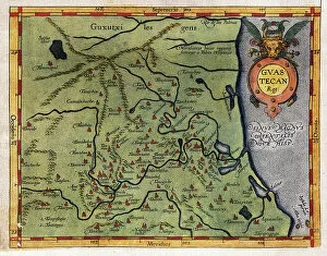
Background imageNetherlands Collection: Map of the Gulf of Mexico (Guastecan), from Hernando de Soto's expedition in 1570 (engraving)

Map of the Gulf of Mexico (Guastecan), from Hernando de Soto's expedition in 1570 (engraving)
AIS5365875 Map of the Gulf of Mexico (Guastecan), from Hernando de Soto's expedition in 1570 (engraving) by Ortelius, Abraham (1527-98); (add.info.: Strong water in colors, 1588)

Background imageNetherlands Collection: Old chromolithograph map of Amsterdam, capital and most populous city of the Netherlands

Old chromolithograph map of Amsterdam, capital and most populous city of the Netherlands
Copyright has expired on this artwork. From my own archives, digitally restored

Background imageNetherlands Collection: Dutch Trade Map of the Baltic Sea

Dutch Trade Map of the Baltic Sea
Dutch Trade map of the Baltic Sea (hand-coloured engraving) During the last decades of the 16th century and throughout the 17th century Dutch merchants

Background imageNetherlands Collection: Old chromolithograph map of Netherlands

Old chromolithograph map of Netherlands
Antique Illustration. Copyright has expired on this artwork. From my own archives, digitally restored

Background imageNetherlands Collection: map of Delft, Netherlands, 1617 (engraving)

map of Delft, Netherlands, 1617 (engraving)
3918326 map of Delft, Netherlands, 1617 (engraving) by Braun, Georg (1541-1622); (add.info.: Delft, Netherlands - in Civitates Orbis Terrarum by Georg Braun)

Background imageNetherlands Collection: Map of the West Indies, Caribbean Sea, Antilles, 1709-1713 (engraving)

Map of the West Indies, Caribbean Sea, Antilles, 1709-1713 (engraving)
VEN5030086 Map of the West Indies, Caribbean Sea, Antilles, 1709-1713 (engraving) by Keulen, Gerard van (1678-1726); Biblioteca Angelica, Rome

Background imageNetherlands Collection: Map of Damme and the Spanish Border Fortresses near Sluis (oil on canvas)

Map of Damme and the Spanish Border Fortresses near Sluis (oil on canvas)
490157 Map of Damme and the Spanish Border Fortresses near Sluis (oil on canvas) by Lobberecht, Jacques (17th century); 132x204.5 cm; Groeningemuseum, Bruges, Belgium; © Art in Flanders

Background imageNetherlands Collection: Map of the Zwin Area (oil on canvas)

Map of the Zwin Area (oil on canvas)
490039 Map of the Zwin Area (oil on canvas) by Hervy, Jehan de (fl.1472-1507); Groeningemuseum, Bruges, Belgium; (add.info.: See also 490038 & 490040.); © Art in Flanders

Background imageNetherlands Collection: Map of the Zwin Area (oil on canvas)

Map of the Zwin Area (oil on canvas)
490040 Map of the Zwin Area (oil on canvas) by Hervy, Jehan de (fl.1472-1507); Groeningemuseum, Bruges, Belgium; (add.info.: See also 490038 & 490039.); © Art in Flanders

Background imageNetherlands Collection: Map of the Zwin Area (oil on canvas)

Map of the Zwin Area (oil on canvas)
490038 Map of the Zwin Area (oil on canvas) by Hervy, Jehan de (fl.1472-1507); Groeningemuseum, Bruges, Belgium; (add.info.: See also 490039 & 490040.); © Art in Flanders

Background imageNetherlands Collection: The Moscow Kremlin Map of the 16th century (Castellum Urbis Moskvae), 1662 (copper engraving & w/c)

The Moscow Kremlin Map of the 16th century (Castellum Urbis Moskvae), 1662 (copper engraving & w/c)
7305379 The Moscow Kremlin Map of the 16th century (Castellum Urbis Moskvae), 1662 (copper engraving & w/c) by Blaeu, Joan (1596-1673); Private Collection; Photo © Fine Art Images

Background imageNetherlands Collection: The Moscow Kremlin Map of the 16th century (Castellum Urbis Moskvae), c. 1600 (engraving & w/c)

The Moscow Kremlin Map of the 16th century (Castellum Urbis Moskvae), c. 1600 (engraving & w/c)
7305377 The Moscow Kremlin Map of the 16th century (Castellum Urbis Moskvae), c.1600 (engraving & w/c) by Blaeu, Joan (1596-1673); Private Collection; Photo © Fine Art Images


All Professionally Made to Order for Quick Shipping


-

Netherlands Collection

Netherlands is a country located in Western Europe, bordered by Germany to the east and Belgium to the south. The country has a population of approximately 17 million people and covers an area of 41,543 square kilometers. Amsterdam is its capital city, while Rotterdam is the largest port in Europe. Netherlands boasts of a highly developed economy with agriculture being one of its main industries. The country's topography comprises low-lying flatlands that are prone to flooding; hence it has invested heavily in water management infrastructure such as dikes and dams. Maps and charts provide detailed information about the geography, demographics, transportation networks, land use patterns among other aspects of this beautiful nation.
+

Our beautiful Wall Art and Photo Gifts include Framed Prints, Photo Prints, Poster Prints, Canvas Prints, Jigsaw Puzzles, Metal Prints and so much more

The Netherlands collection from Media Storehouse offers a wide range of wall art and framed prints that depict the geography, history, and culture of this European country. Our collection features vintage maps, charts, and illustrations that showcase the intricate canal system, windmills, tulip fields, iconic landmarks such as the Rijksmuseum and Anne Frank House in Amsterdam. These artworks also provide an insight into Dutch maritime history with depictions of famous ships like VOC or East India Company vessels. Our collection is curated to cater to diverse tastes with various styles ranging from antique engravings to modern digital designs. The high-quality prints are available in different sizes making them suitable for any room decor. Whether you're looking for a unique gift or want to add some character to your home or office space, the Netherlands collection has something for everyone who appreciates Dutch heritage.
+

What are Netherlands (Maps and Charts) art prints?

Netherlands art prints are a collection of high-quality, visually stunning images that showcase the geography and history of the Netherlands. These prints feature detailed maps and charts that highlight various regions, cities, rivers, canals, and landmarks throughout the country. The artwork is created using advanced printing techniques to ensure vibrant colors and crisp details. These art prints are perfect for anyone who loves Dutch culture or wants to learn more about the country's rich history. They make great additions to any home or office decor, adding a touch of sophistication and elegance to any space. Whether you're looking for a unique gift idea or want to decorate your own walls with beautiful artwork, these Netherlands art prints are sure to impress. We offer a wide variety of sizes and framing options so you can customize your print exactly how you want it. With fast shipping times and excellent customer service, ordering from Media Storehouse is easy and hassle-free.
+

What Netherlands (Maps and Charts) art prints can I buy from Media Storehouse?

We offer a wide range of Netherlands art prints in the form of maps and charts. These prints showcase the beauty and history of this European country, with stunning depictions of its cities, landmarks, and landscapes. Some popular options include antique maps that show the layout and geography of different regions within the Netherlands, as well as vintage charts that highlight important historical events or cultural traditions. In addition to traditional paper prints, Media Storehouse also offers canvas prints that can be stretched over a frame for easy display on your wall. These high-quality reproductions are perfect for adding a touch of Dutch charm to any room in your home or office. Whether you're looking for a unique gift or simply want to decorate your own space with beautiful artwork inspired by the Netherlands, we have something for everyone. With our extensive collection of maps and charts from this fascinating country, you're sure to find just what you're looking for.
+

How do I buy Netherlands (Maps and Charts) art prints?

To buy Netherlands art prints from Media Storehouse, you can browse through our extensive collection of artwork online. Once you have found the print that you like, simply add it to your cart and proceed to checkout. You will be prompted to enter your shipping and payment information before finalizing your purchase. We offer a variety of sizes for their prints, so make sure to select the size that best fits your needs. We also offer different framing options if you prefer a framed print. If you have any questions or concerns about purchasing Netherlands art prints from Media Storehouse, they have a customer service team available to assist you. Simply reach out to them via email or phone for help with your order. Buying Netherlands art prints from Media Storehouse is easy and convenient thanks to their user-friendly website and helpful customer service team.
+

How much do Netherlands (Maps and Charts) art prints cost?

We offer a wide range of Netherlands art prints at varying prices. Our collection includes high-quality reproductions of vintage maps and charts depicting the geography, topography, and history of the Netherlands. The cost of each print depends on several factors such as its size, quality, and rarity. We have options for every budget ranging from affordable posters to premium giclee prints that are perfect for collectors or those who want museum-quality artwork in their homes or offices. Our prints are available in different sizes to suit your needs and preferences. Whether you're looking for a unique gift or want to add some character to your space, our Netherlands art prints are an excellent choice. With our extensive selection of designs at various price points, you're sure to find something that fits your style and budget.
+

How will my Netherlands (Maps and Charts) art prints be delivered to me?

Your Netherlands art prints will be delivered to you in a safe and secure manner. We take great care in ensuring that your artwork arrives at your doorstep in pristine condition. We use high-quality packaging materials to protect your prints during transit. Your order will be shipped using reliable shipping carriers who have a proven track record of delivering packages on time. You can rest assured that your package will arrive on schedule. We offer various delivery options depending on the size and weight of your order. Our standard delivery option is available for most orders, while expedited shipping is available for those who need their prints sooner. Once your order has been dispatched, we will send you an email with tracking information so you can keep an eye on its progress as it makes its way to you. We guarantee that your Netherlands art prints will be delivered safely and securely right to your door.