Fraud Blocker Skip to main content

Home > Maps and Charts > Greece

Greece Collection (#5)

Greece is a country located in southeastern Europe, with a population of approximately 10.7 million people

1,412 Items

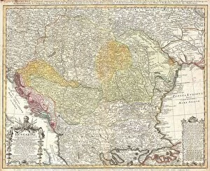
Background imageGreece Collection: 1752 Homann Heirs Map Of Hungary The Balkans

1752 Homann Heirs Map Of Hungary The Balkans
1752, Homann Heirs Map of Hungary, the Balkans, and Northern Greece

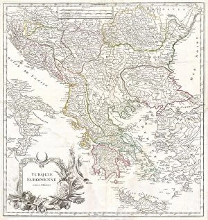
Background imageGreece Collection: 1752 Vaugondy Map Of Greece Macedonia And Albania

1752 Vaugondy Map Of Greece Macedonia And Albania
1752, Vaugondy Map of Greece, Macedonia and Albania

Background imageGreece Collection: 1741 Homann Heirs Map Of Ancient Greece And The Eastern Mediterranean

1741 Homann Heirs Map Of Ancient Greece And The Eastern Mediterranean
1741, Homann Heirs Map of Ancient Greece and the Eastern Mediterranean

Background imageGreece Collection: 1584 Ortelius Map Of Crete Candia And 10 Greek Islands

1584 Ortelius Map Of Crete Candia And 10 Greek Islands
1584, Ortelius Map of Crete, Candia and 10 Greek Islands, Abraham Ortelius, also Orthellius, 1527 - 1598, Flemish, Netherlandish cartographer and geographer

Background imageGreece Collection: Map showing the German advance in Greece, 6-30 April, 1941. From The War in Pictures, Sixth Year

Map showing the German advance in Greece, 6-30 April, 1941. From The War in Pictures, Sixth Year

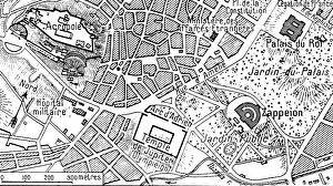
Background imageGreece Collection: Athenes vue en avion; Plan correspondant a la photographie ci-dessous, 1916. Creator: Unknown

Athenes vue en avion; Plan correspondant a la photographie ci-dessous, 1916. Creator: Unknown
Athenes vue en avion; Plan correspondant a la photographie ci-dessous, 1916. From "Collection de la Guerre IV. L'Illustration Tome CXLVIII

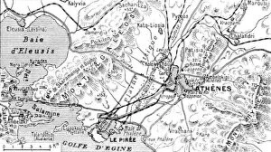
Background imageGreece Collection: Athenes vue en avion; Athenes et son port le Piree, 1916. Creator: Unknown

Athenes vue en avion; Athenes et son port le Piree, 1916. Creator: Unknown
Athenes vue en avion; Athenes et son port le Piree, 1916. From "Collection de la Guerre IV. L'Illustration Tome CXLVIII

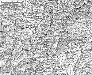
Background imageGreece Collection: Frontiere greco-serbe; terrain ou s'est deployee l'offensive de septembre a la frontiere... 1916

Frontiere greco-serbe; terrain ou s'est deployee l'offensive de septembre a la frontiere... 1916
Frontiere greco-serbe; terrain ou s'est deployee l'offensive de septembre a la frontiere greco-serbe, de part et d'autre du lac d'Ostrovo. 1916. From "Collection de la Guerre IV

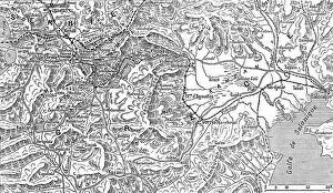
Background imageGreece Collection: La Campagne Macedonienne; De Salonique a Monastir, 1916. Creator: Unknown

La Campagne Macedonienne; De Salonique a Monastir, 1916. Creator: Unknown
La Campagne Macedonienne; De Salonique a Monastir. 1916. From "Collection de la Guerre IV. L'Illustration Tome CXLVII. La Guerre Juillet, Aout, Septembre, Octobre, Novembre, Decembre 1916"

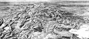
Background imageGreece Collection: Panorama du theatre des operations des armees alliees, 1916. Creator: Unknown

Panorama du theatre des operations des armees alliees, 1916. Creator: Unknown
Panorama du theatre des operations des armees alliees (Francais, anglais, serbes, russes et Italiens) de la frontiere d'Albanie au golfe de Cavala, 1916. From "Collection de la Guerre IV

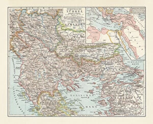
Background imageGreece Collection: Historical map of the Ottoman Empire (Turkey), European part, 1897

Historical map of the Ottoman Empire (Turkey), European part, 1897
Historical map of European part of the Ottoman Empire (Turkey) at the end of the 19th century. Lithograph, published in 1897

Background imageGreece Collection: Old map of Greece, steel engraving, published 1857

Old map of Greece, steel engraving, published 1857
Old map of Greece. Steel engraving with hand coloured borderlines, published in 1857

Background imageGreece Collection: 1 Maps 45

1 Maps 45
Emiliano Deificus

Background imageGreece Collection: City Love Maps 05

City Love Maps 05
Emiliano Deificus

Background imageGreece Collection: Black Maps 05

Black Maps 05
Emiliano Deificus

Background imageGreece Collection: Charon transports the souls of the dead to the kingdom of Hades, 2nd half of 19th century

Charon transports the souls of the dead to the kingdom of Hades, 2nd half of 19th century. Creator: Mikhail Znamensky
Charon transports the souls of the dead to the kingdom of Hades, 2nd half of 19th century. From a collection of 239 drawings

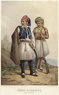
Background imageGreece Collection: Greek and Arnaut, 1862. Creator: Karl Fiale

Greek and Arnaut, 1862. Creator: Karl Fiale
Greek and Arnaut, 1862. Sheet 19 from the album "Description ethnographique des peuples de la Russie", volume 1

Background imageGreece Collection: Statue of greco-roman origin of Atlas with the world on his shoulders

Statue of greco-roman origin of Atlas with the world on his shoulders. In the Museo Nazionale of Naples Naples Statue Hellenistic, Greek Art, Greece, Europe, Ancient Civilization

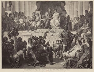
Background imageGreece Collection: Marriage of Alexander the Great and Stateira II in Susa, Persia, 324 BC (engraving)

Marriage of Alexander the Great and Stateira II in Susa, Persia, 324 BC (engraving)
7157369 Marriage of Alexander the Great and Stateira II in Susa, Persia, 324 BC (engraving) by German School, (19th century); Private Collection; (add.info)

Background imageGreece Collection: Minoan art. Cycladic-typed marble figurine, 2600-2300 BC

Minoan art. Cycladic-typed marble figurine, 2600-2300 BC
7145073 Minoan art. Cycladic-typed marble figurine, 2600-2300 BC by Minoan; Archaeological Museum of Heraklion, Crete, Greece; (add.info.: Cycladic-typed marble figurine of a standing pregnant woman)

Background imageGreece Collection: Detail of the Statue of the godess Persephone, 2nd century

Detail of the Statue of the godess Persephone, 2nd century
7145302 Detail of the Statue of the godess Persephone, 2nd century by Roman, (2nd century AD); Archaeological Museum of Heraklion, Crete

Background imageGreece Collection: Map of the world, based on descriptions and co-ordinates given in Geographia

Map of the world, based on descriptions and co-ordinates given in Geographia
NBY259407 Map of the world, based on descriptions and co-ordinates given in Geographia first published in Ulm, Germany, 1482 (colour litho) by Ptolemy (Claudius Ptolemaeus of Alexandria)(c.90-168)

Background imageGreece Collection: George Bradshaws Plan of Naples, Greece 1896

George Bradshaws Plan of Naples, Greece 1896
This is a detailed Plan of the Port and City of Naples showing the streets, canals, principal buildings, railways and railway stations

Background imageGreece Collection: Maps of the ancient and new Syracuse, Italy, published 1897

Maps of the ancient and new Syracuse, Italy, published 1897
Historical maps of the ancient and new (left) Syracuse, Sicily, Italy. Wood engraving, published in 1897

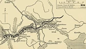
Background imageGreece Collection: The Allies Line facing the Bulgarians in the closing Campaign of 1916, (c1920)

The Allies Line facing the Bulgarians in the closing Campaign of 1916, (c1920). Map of Salonika (Thessaloniki) in Greece, showing Allied positions during the First World War: Russian, French

Background imageGreece Collection: Modern Night Sky Constellation - Canis Major

Modern Night Sky Constellation - Canis Major
Simple, modern depiction of a celestial constellation. The constellation Canis Major is located in the southern hemisphere of the sky

Background imageGreece Collection: Modern Night Sky Constellation - Leo

Modern Night Sky Constellation - Leo
Simple, modern depiction of a celestial constellation on a navy backdrop. Leo constellation lies in the northern sky and is one of the zodiac constellations

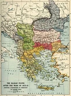
Background imageGreece Collection: The Balkan States After the Wars of 1912-13, (c1920). Creator: John Bartholomew & Son

The Balkan States After the Wars of 1912-13, (c1920). Creator: John Bartholomew & Son
The Balkan States After the Wars of 1912-13, (c1920). Showing Acquisitions of Territory in Darker Tints. Map of the Balkans: Bosnia, Montenegro, Servia (Serbia), Albania, Roumania (Romania)

Background imageGreece Collection: Map of Assyria, Chaldea and Adjacent Countries, 1890. Creator: Unknown

Map of Assyria, Chaldea and Adjacent Countries, 1890. Creator: Unknown
Map of Assyria, Chaldea and Adjacent Countries, 1890. Assyria was a Mesopotamian kingdom from 25th century BC to 612 BC- 609 BC

Background imageGreece Collection: Map of Greece in the Heroic age 1889

Map of Greece in the Heroic age 1889
Comprehensive Geography by James Monteith - American Book Company 1882, 1889

Background imageGreece Collection: Map of the World, According to Ptolemy, 1923. Creator: Agathodaemon of Alexandria

Map of the World, According to Ptolemy, 1923. Creator: Agathodaemon of Alexandria
Map of the World, According to Ptolemy, 1923. From " Australia, New Zealand and Oceania in Pictures", by H. Clive Barnard, M.A. Blitt. [A. & C. Black, Limited, London, 1923]

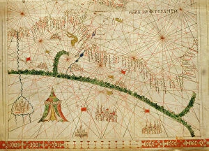
Background imageGreece Collection: North Africa, from a nautical atlas, 1520 (ink on vellum) (detail from 330916)

North Africa, from a nautical atlas, 1520 (ink on vellum) (detail from 330916)
XOT330918 North Africa, from a nautical atlas, 1520 (ink on vellum) (detail from 330916) by Giovanni Xenodocus da Corfu (fl. 16th Century); Museo Correr, Venice, Italy; Greek, out of copyright

Background imageGreece Collection: Antique map of Ancient Italy and Greece

Antique map of Ancient Italy and Greece
Vintage engraving of a Antique map of Ancient Italy and Greece

Background imageGreece Collection: Map of Greece 1900

Map of Greece 1900
Meyers hand-Atlas Leipzig und Wien Verlag des Bibliographischen Instituts 1900

Background imageGreece Collection: Antique Map of the Assyrian Empire

Antique Map of the Assyrian Empire
Antique Map from 1862 of Assyrian Empire also showing Phoenician and Greek colonies circa 627 BC. Maps text is written in Latin

Background imageGreece Collection: Sea area of the State of the Veneto: Greece, divided into its Provinces, engraving by G

Sea area of the State of the Veneto: Greece, divided into its Provinces, engraving by G. Zuliani taken from Tome III of the "Newest Atlas" published in Venice in 1781 by Antonio Zatta

Background imageGreece Collection: 'Sala dell'Atlante', Hall of National Archaeological Museum in Naples

"Sala dell'Atlante", Hall of National Archaeological Museum in Naples
"Sala dell'Atlante", Hall of National Archaeological Museum in Naples Naples The National Archaeological Museum Statue Hellenistic, Greek Art, Greece, Europe, Ancient Civilization

Background imageGreece Collection: Farnese Atlas, statue located at the National Archaeological Musem in Naples

Farnese Atlas, statue located at the National Archaeological Musem in Naples. Naples National Archaeological Musem Statue Hellenistic, Greek Art, Greece, Europe, Ancient Civilization

Background imageGreece Collection: Statue of Atlas with the celestial globe called the Farnese Atlas, marble

Statue of Atlas with the celestial globe called the Farnese Atlas, marble, Greek art of the second century. A.D. National Archaeological Museum

Background imageGreece Collection: Wall painting of Orpheus with lyre from the viridarium (garden) of the House of Vesonius Primus

Wall painting of Orpheus with lyre from the viridarium (garden) of the House of Vesonius Primus, a fuller
FLO4686859 Wall painting of Orpheus with lyre from the viridarium (garden) of the House of Vesonius Primus, a fuller. He is surrounded by animals including a lion, cougar, boar, stag, rabbit

Background imageGreece Collection: Ariadne watching Theseus's boat depart from the island of Naxos

Ariadne watching Theseus's boat depart from the island of Naxos. Mural from a triclinium in a shop/dwelling at
FLO4686919 Ariadne watching Theseus's boat depart from the island of Naxos. Mural from a triclinium in a shop/dwelling at Regio IX.II.5, Pompeii

Background imageGreece Collection: Achaia, Thebes and Athens, Greece

Achaia, Thebes and Athens, Greece

Background imageGreece Collection: Castel Ruggio, Cisme, Greece

Castel Ruggio, Cisme, Greece

Background imageGreece Collection: Part of Greece Showing, Athens, Crete and Rhodes

Part of Greece Showing, Athens, Crete and Rhodes

Background imageGreece Collection: Port St Ange, South of The Island of Simi, Greece

Port St Ange, South of The Island of Simi, Greece

Background imageGreece Collection: 13849201

13849201

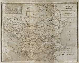
Background imageGreece Collection: European Turkey map by Th. Duvotenay

European Turkey map by Th. Duvotenay
European Turkey map by Thunot Duvotenay. Historia de Turquia by Joseph Marie Jouannin (1783-1844) and Jules Van Gaver, 1840. Date: 2018

Background imageGreece Collection: Advert, The Hellenic Mediterranean Lines, Greece

Advert, The Hellenic Mediterranean Lines, Greece
Advert, The Hellenic Mediterranean Lines, Piraeus, Greece Date: 1955


All Professionally Made to Order for Quick Shipping


-

Greece Collection

Greece is a country located in southeastern Europe, with a population of approximately 10.7 million people. The country has an area of 131,957 square kilometers and is divided into thirteen administrative regions. Greece's capital city is Athens, which is also the largest city in the country. The geography includes numerous islands scattered throughout the Aegean and Ionian Seas, as well as mountainous terrain on the mainland. The highest point is Mount Olympus at 2,917 meters. A rich history dating back to ancient times when it was home to some of the world's most famous philosophers and mathematicians such as Socrates, Plato, and Aristotle. Today, Greece remains an important cultural center with many historical landmarks including the Acropolis in Athens and Delphi archaeological site. Overall, maps and charts can provide valuable insights into various aspects of Greek society such as demographics or economic activity while also showcasing its unique geography and cultural heritage.
+

Our beautiful Wall Art and Photo Gifts include Framed Prints, Photo Prints, Poster Prints, Canvas Prints, Jigsaw Puzzles, Metal Prints and so much more

The Greece collection from Media Storehouse is a stunning assortment of wall art and framed prints that showcases the beauty, history, and culture of Greece. Our collection features an array of maps and charts that depict various regions, cities, islands, landmarks, and historical events in Greece. The maps are intricately detailed with accurate geographical information such as topography, rivers, mountains, coastlines etc., while the charts provide valuable insights into ancient Greek mythology, philosophy or architecture. These artworks are printed on high-quality paper using advanced printing technology to ensure vibrant colors and sharp details. They come in different sizes to suit any space or decor style. Whether you're a history buff or simply love the Mediterranean charm of Greece's landscapes and seascapes - our collection has something for everyone. Overall our collection offers a unique opportunity to bring some Greek heritage into your home or office space through beautiful artwork that captures its rich cultural legacy.
+

What are Greece (Maps and Charts) art prints?

Greece art prints are a collection of high-quality, visually stunning reproductions of maps and charts depicting the geography, history, culture, and landmarks of Greece. These art prints showcase the intricate details of ancient Greek architecture, mythology, and landscapes in vivid colors that capture the essence of this beautiful country. These prints are perfect for anyone who loves Greece or wants to learn more about its rich heritage. They make great gifts for travelers or those interested in history or geography. The collection includes a variety of styles from vintage to modern designs that will suit any decor style. Whether you're looking for a map to hang on your wall or an artistic representation of Greece's famous landmarks like the Acropolis or Santorini's blue-domed churches overlooking the Aegean Sea - these art prints are sure to impress with their attention to detail and quality craftsmanship.
+

What Greece (Maps and Charts) art prints can I buy from Media Storehouse?

We offer a wide variety of Greece art prints in the form of maps and charts. These prints showcase the beauty and history of Greece, including its stunning landscapes, ancient ruins, and iconic landmarks. Some popular options include detailed maps of Athens or Crete, vintage travel posters featuring Greek islands like Santorini or Mykonos, and historical charts depicting the mythology and gods of Ancient Greece. In addition to these traditional map and chart styles, Media Storehouse also offers modern interpretations that incorporate bold colors and abstract designs. Whether you're looking for a classic depiction of Greece's rich cultural heritage or a contemporary take on its natural wonders, there is sure to be an art print that suits your taste. All prints are available in various sizes to fit any space in your home or office. They are printed using high-quality materials to ensure vibrant colors and crisp details that will last for years to come.
+

How do I buy Greece (Maps and Charts) art prints?

To buy Greece art prints from Media Storehouse, you can browse our extensive collection of high-quality prints online. Simply search for the specific artwork or artist you are interested in, or explore their curated collections to discover new pieces. Once you have found a print that catches your eye, select the size and framing options that best suit your needs. You can choose from a range of materials and finishes to create a custom look that complements your decor. When you are ready to purchase, simply add the item to your cart and proceed through the checkout process. We accept various payment methods for easy and secure transactions. Whether you are looking for a unique piece of wall art for your home or office, or searching for a special gift for someone who loves Greece , we have something to suit every taste and budget.
+

How much do Greece (Maps and Charts) art prints cost?

We offer a wide range of Greece art prints at varying prices. Our collection includes high-quality prints featuring maps and charts of Greece that are perfect for adding a touch of sophistication to any room in your home or office. The cost of our Greece art prints depends on the size, framing options, and other customizations you choose. We take pride in offering affordable yet premium quality artwork that is sure to impress anyone who sees it. Whether you're looking for a small print to hang on your wall or a large canvas to make a statement piece, we have something for everyone's budget. Our team works hard to ensure that each order is processed quickly and efficiently so you can enjoy your new artwork as soon as possible. So if you're looking for beautiful Greece art prints at reasonable prices, look no further than Media Storehouse.
+

How will my Greece (Maps and Charts) art prints be delivered to me?

We take great care in ensuring that your Greece art prints are delivered to you safely and securely. We use high-quality packaging materials to protect your artwork during transit, so it arrives in pristine condition. Your prints will be carefully rolled and placed into a sturdy cardboard tube for delivery. This ensures that they remain flat and free from creases or damage during transportation. The tube is then sealed with tape to prevent any moisture or dust from entering. Once your order has been dispatched, you will receive an email confirmation with tracking information so you can monitor the progress of your delivery. Our shipping partners are reliable and efficient, ensuring that your package arrives on time. We pride ourselves on providing excellent customer service, so if there are any issues with the delivery of your Greece art prints, please do not hesitate to contact us.