Fraud Blocker Skip to main content

Home > Maps and Charts > Germany

Germany Collection (#8)

Germany is a country located in central Europe with a population of over 83 million people and has a diverse landscape

6,586 Items

Background imageGermany Collection: Altlantique Limulus polyphemus, arthropod chelicere. Colour illustration by Heinrich Harder

Altlantique Limulus polyphemus, arthropod chelicere. Colour illustration by Heinrich Harder (1858-1935)
FLO4639195 Altlantique Limulus polyphemus, arthropod chelicere. Colour illustration by Heinrich Harder (1858-1935), in " Tiere der Urwelt" (Animals of Prehistory)

Background imageGermany Collection: The pteranodons (wings without teeth) were large flying dinosaurs

The pteranodons (wings without teeth) were large flying dinosaurs, with a wingspan of more than 9 metres
FLO4639182 The pteranodons (wings without teeth) were large flying dinosaurs, with a wingspan of more than 9 metres, and lived in the Upper Cretace period

Background imageGermany Collection: Dinocerata, (Terrible a horn) species of herbivore, resembling rhinoceros

Dinocerata, (Terrible a horn) species of herbivore, resembling rhinoceros
FLO4639842 Dinocerata, (Terrible a horn) species of herbivore, resembling rhinoceros, creature a hoof famous for their paired horns and their canine defenses

Background imageGermany Collection: Two Archeopteryx searching the shore. These missing animals are considered the oldest known animals

Two Archeopteryx searching the shore. These missing animals are considered the oldest known animals
FLO4639193 Two Archeopteryx searching the shore. These missing animals are considered the oldest known animals. They lived in the Upper Jurassic period 150 to 148 million years ago

Background imageGermany Collection: Weimar, Germany

Weimar, Germany
2901912 Weimar, Germany; (add.info.: Located on Ilm river; was medieval center; ruled by counts of Weimar-Orlamde from 1247)

Background imageGermany Collection: Map of Alsace-Lorraine in 1882 showing areas taken by Germans and areas they are going to take

Map of Alsace-Lorraine in 1882 showing areas taken by Germans and areas they are going to take
1751379 Map of Alsace-Lorraine in 1882 showing areas taken by Germans and areas they are going to take (context of annexation of Alsace-Lorraine by Germany after 1870 war); (add.info)

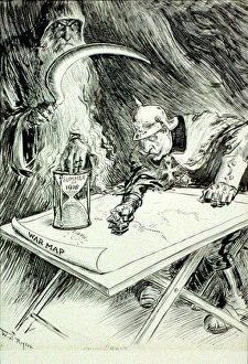
Background imageGermany Collection: Wilhelm II (1859-1941) Emperor of Germany 1888-1918, mailed fist on War Map

Wilhelm II (1859-1941) Emperor of Germany 1888-1918, mailed fist on War Map, looks at sand glass labelled Summer 1918
528344 Wilhelm II (1859-1941) Emperor of Germany 1888-1918, mailed fist on War Map, looks at sand glass labelled Summer 1918, while Father Time, the Grim Reaper is ready to strike. World War I

Background imageGermany Collection: Map of Hamburg, c.1900 (engraving)

Map of Hamburg, c.1900 (engraving)
532767 Map of Hamburg, c.1900 (engraving); (add.info.: Map of Hamburg, circa 1900, from the 10th edition of Encyclopaedia Britannica.); Encyclopaedia Britannica/UIG

Background imageGermany Collection: Map of Berlin, c.1900 (engraving)

Map of Berlin, c.1900 (engraving)
532708 Map of Berlin, c.1900 (engraving); (add.info.: Map of the city of Berlin and vicinity, Germany, circa 1900, from the 10th edition of Encyclopaedia Britannica.); Encyclopaedia Britannica/UIG

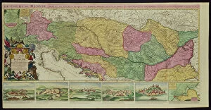
Background imageGermany Collection: The Course of the Danube from its Source to its Mouth, based on the most recent memoires of P

The Course of the Danube from its Source to its Mouth, based on the most recent memoires of P. Coroneli and S
NUL116588 The Course of the Danube from its Source to its Mouth, based on the most recent memoires of P. Coroneli and S. Sanson, Geographer to the King (colour litho) by French School

Background imageGermany Collection: Handforth Camp: The Office, note the War Map on the Wall (b/w photo)

Handforth Camp: The Office, note the War Map on the Wall (b/w photo)
8670218 Handforth Camp: The Office, note the War Map on the Wall (b/w photo) by English Photographer, (20th century); Private Collection; (add.info.: The Office, note the War Map on the Wall)

Background imageGermany Collection: Famous rivers: The Rhine (litho)

Famous rivers: The Rhine (litho)
8634758 Famous rivers: The Rhine (litho) by English School, (20th century); Private Collection; (add.info.: The Rhine. Illustration for Chatterbox, 1913.); © Look and Learn

Background imageGermany Collection: Map of the Earth according to Herodotus (engraving)

Map of the Earth according to Herodotus (engraving)
8635073 Map of the Earth according to Herodotus (engraving) by German School, (19th century) (after); Private Collection; (add.info)

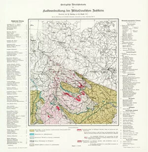
Background imageGermany Collection: Potash deposits in Germany (colour litho)

Potash deposits in Germany (colour litho)
8663962 Potash deposits in Germany (colour litho) by German School, (20th century); Private Collection; (add.info.: Geological map of the distribution of potash deposits in Germany)

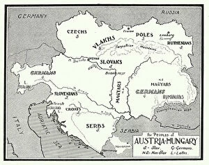
Background imageGermany Collection: The Peoples of Austria-Hungary, 1915 (litho)

The Peoples of Austria-Hungary, 1915 (litho)
8641513 The Peoples of Austria-Hungary, 1915 (litho) by English School, (20th century); Private Collection; (add.info.: The Peoples of Austria-Hungary, 1915)

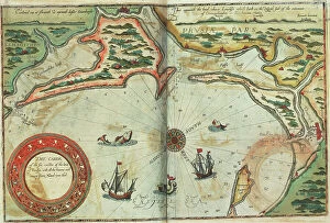
Background imageGermany Collection: Coast of Prussia with all the havens and rivers from Memel to Heel, 1588 (coloured engraving)

Coast of Prussia with all the havens and rivers from Memel to Heel, 1588 (coloured engraving)
7340016 Coast of Prussia with all the havens and rivers from Memel to Heel, 1588 (coloured engraving) by Janszoon Waghenaer, Lucas (c.1533-c.1606) ; 33x51 cm; National Maritime Museum, London

Background imageGermany Collection: Map of Scandinavia, 1554 (vellum)

Map of Scandinavia, 1554 (vellum)
7339651 Map of Scandinavia, 1554 (vellum) by Agnese, Battista (c.1500-64); 26x40 cm; National Maritime Museum, London, UK; (add.info.: Creator)

Background imageGermany Collection: Chart of Moscow and the Black Sea, 1554 (vellum)

Chart of Moscow and the Black Sea, 1554 (vellum)
7339650 Chart of Moscow and the Black Sea, 1554 (vellum) by Agnese, Battista (c.1500-64); 26x40 cm; National Maritime Museum, London, UK; (add.info.: Creator: Johan B. Agnese Moscaw oder Reuss')

Background imageGermany Collection: Germany: geographical map of Germany and neighbouring States. 1493

Germany: geographical map of Germany and neighbouring States. 1493
FGL5465921 Germany: geographical map of Germany and neighbouring States. 1493.; Fototeca Gilardi

Background imageGermany Collection: First World War: Patriotic map showing in a buccolic trench an English

First World War: Patriotic map showing in a buccolic trench an English and Belgian French soldier playing the map
LUX4744615 First World War: Patriotic map showing in a buccolic trench an English and Belgian French soldier playing the map between battles

Background imageGermany Collection: First World War: Patriotic map showing an English soldier at the front

First World War: Patriotic map showing an English soldier at the front and titled Glory to our Ally, 1916
LUX4744763 First World War: Patriotic map showing an English soldier at the front and titled Glory to our Ally, 1916; (add.info.: World War I - War 14-18 (1914-1918) - World War I (WWI or WW1)

Background imageGermany Collection: United States, State of Pennsylvania: Map of the ' Province of Pennsilvania

United States, State of Pennsylvania: Map of the " Province of Pennsilvania
NWI4967179 United States, State of Pennsylvania: Map of the " Province of Pennsilvania, " when the country was a colony 1756

Background imageGermany Collection: United States, Virginia: Jamestown (James river) camp map by Jonh Smith

United States, Virginia: Jamestown (James river) camp map by Jonh Smith, Virginia near the Atlantic coast
NWI4967563 United States, Virginia: Jamestown (James river) camp map by Jonh Smith, Virginia near the Atlantic coast. Colour engraving of the 19th century; (add.info.: United States)

Background imageGermany Collection: A description of the sea coastes of Eyder Ditmers and a part of Jeverland with the rivers of

A description of the sea coastes of Eyder Ditmers and a part of Jeverland with the rivers of Weser, Elve, Eyder
7340017 A description of the sea coastes of Eyder Ditmers and a part of Jeverland with the rivers of Weser, Elve, Eyder, Hever and other entrees sandes and shoaldes

Background imageGermany Collection: Battle of Sedan, 1870. Map

Battle of Sedan, 1870. Map
7301610 Battle of Sedan, 1870. Map.; Private Collection; (add.info.: The Battle of Sedan 1 - 2 September 1870 during the Franco-Prussian War 1870 - 1871)

Background imageGermany Collection: Map 'Hamburg about 1550', 1866 (engraving)

Map "Hamburg about 1550", 1866 (engraving)
UTD4920385 Map "Hamburg about 1550", 1866 (engraving); (add.info.: Germany, Hamburg, map " Hamburg about 1550 ")

Background imageGermany Collection: Map of the Roman Empire in the 3rd century. The territory occupies North Africa

Map of the Roman Empire in the 3rd century. The territory occupies North Africa, the coasts of the Mediterranean Sea
NWI4857392 Map of the Roman Empire in the 3rd century. The territory occupies North Africa, the coasts of the Mediterranean Sea, Samarte country, Asia Minor, Near East, Gaul, Germany

Background imageGermany Collection: Map of the Kingdom of Prussia in 1786, and of Brandenburg in 1415 (Germany)

Map of the Kingdom of Prussia in 1786, and of Brandenburg in 1415 (Germany). 19th century lithography
NWI4871497 Map of the Kingdom of Prussia in 1786, and of Brandenburg in 1415 (Germany). 19th century lithography.; (add.info.: Map of the Kingdom of Prussia in 1786)

Background imageGermany Collection: Map of London with enclosure and fortifications around the Tower of London in England during

Map of London with enclosure and fortifications around the Tower of London in England during the regne of Elizabeth I
NWI4873555 Map of London with enclosure and fortifications around the Tower of London in England during the regne of Elizabeth I, 16th century

Background imageGermany Collection: Map of the Earl of Kent (England), circa 1870. 19th century lithography

Map of the Earl of Kent (England), circa 1870. 19th century lithography
NWI4875009 Map of the Earl of Kent (England), circa 1870. 19th century lithography.; (add.info.: Map of the Earl of Kent (England), circa 1870

Background imageGermany Collection: Map of the Counts of Huntingdon and Cambridge (England), circa 1870. 19th century lithography

Map of the Counts of Huntingdon and Cambridge (England), circa 1870. 19th century lithography
NWI4874992 Map of the Counts of Huntingdon and Cambridge (England), circa 1870. 19th century lithography.; (add.info.: Map of the Counts of Huntingdon and Cambridge (England), circa 1870

Background imageGermany Collection: Map of the Earl of Derbyshire (East Midlands, England), circa 1870. 19th century lithography

Map of the Earl of Derbyshire (East Midlands, England), circa 1870. 19th century lithography
NWI4874760 Map of the Earl of Derbyshire (East Midlands, England), circa 1870. 19th century lithography.; (add.info.: Map of the Earl of Derbyshire (East Midlands, England), circa 1870

Background imageGermany Collection: Map of Cornwall (Plateau or Peninsula of Cornwall, England), circa 1870. 19th century lithography

Map of Cornwall (Plateau or Peninsula of Cornwall, England), circa 1870. 19th century lithography
NWI4874712 Map of Cornwall (Plateau or Peninsula of Cornwall, England), circa 1870. 19th century lithography.; (add.info.: Map of Cornwall (Plateau or Peninsula of Cornwall, England), circa 1870

Background imageGermany Collection: Map of the Counts of Northampton and Bedford (England), circa 1870. 19th century lithography

Map of the Counts of Northampton and Bedford (England), circa 1870. 19th century lithography
NWI4875233 Map of the Counts of Northampton and Bedford (England), circa 1870. 19th century lithography.; (add.info.: Map of the Counts of Northampton and Bedford (England), circa 1870

Background imageGermany Collection: Map of the Earl of Hampshire (England) and the Isle of Wight, circa 1870. 19th century lithography

Map of the Earl of Hampshire (England) and the Isle of Wight, circa 1870. 19th century lithography
NWI4874917 Map of the Earl of Hampshire (England) and the Isle of Wight, circa 1870. 19th century lithography.; (add.info.: Map of the Earl of Hampshire (England) and the Isle of Wight, circa 1870

Background imageGermany Collection: Map of the Count of Essex (England), circa 1870. 19th century lithography

Map of the Count of Essex (England), circa 1870. 19th century lithography
NWI4874886 Map of the Count of Essex (England), circa 1870. 19th century lithography.; (add.info.: Map of the Count of Essex (England), circa 1870

Background imageGermany Collection: Map of the Earl of Cumberland (England), circa 1870. 19th century lithography

Map of the Earl of Cumberland (England), circa 1870. 19th century lithography
NWI4874749 Map of the Earl of Cumberland (England), circa 1870. 19th century lithography.; (add.info.: Map of the Earl of Cumberland (England), circa 1870

Background imageGermany Collection: Germany, Thuringia, the Wartburg, lower floor of the so called Landgrafenhaus, 1876 (engraving)

Germany, Thuringia, the Wartburg, lower floor of the so called Landgrafenhaus, 1876 (engraving)
UTD4916384 Germany, Thuringia, the Wartburg, lower floor of the so called Landgrafenhaus, 1876 (engraving); (add.info.: Germany, Thuringia, the Wartburg, lower floor of the so called Landgrafenhaus)

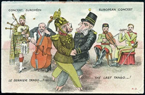
Background imageGermany Collection: First World War: France, Humorous map showing the two Austrian

First World War: France, Humorous map showing the two Austrian and German emperors in pig on a dance imposed by
LUX4736554 First World War: France, Humorous map showing the two Austrian and German emperors in pig on a dance imposed by the allies and nicknamed "the last tango"

Background imageGermany Collection: First World War: France, Postcard, studio photo showing a French soldier in uniform in a flower

First World War: France, Postcard, studio photo showing a French soldier in uniform in a flower field next to
LUX4736083 First World War: France, Postcard, studio photo showing a French soldier in uniform in a flower field next to the German border post destroyed

Background imageGermany Collection: First World War: France, Postcard, photo studio of two soldiers in uniform with machine gun in a

First World War: France, Postcard, photo studio of two soldiers in uniform with machine gun in a green field
LUX4735869 First World War: France, Postcard, photo studio of two soldiers in uniform with machine gun in a green field and protected by France in helmet and flag

Background imageGermany Collection: First World War: France, Patriotic Map showing Napoleon 1st trampling the German flag saying

First World War: France, Patriotic Map showing Napoleon 1st trampling the German flag saying
LUX4741666 First World War: France, Patriotic Map showing Napoleon 1st trampling the German flag saying: I got your Rhine and we'll have it again

Background imageGermany Collection: First World War: France, Patriotic Map showing a young boy and a young girl and kepi

First World War: France, Patriotic Map showing a young boy and a young girl and kepi
LUX4738290 First World War: France, Patriotic Map showing a young boy and a young girl and kepi and Alsatian hat piercing a scarecrow wearing a German helmet

Background imageGermany Collection: First World War: France, Comedy patriotic map showing the German soldier leaving the clocks

First World War: France, Comedy patriotic map showing the German soldier leaving the clocks
LUX4737553 First World War: France, Comedy patriotic map showing the German soldier leaving the clocks and candlesticks flying to pick up a buche

Background imageGermany Collection: First World War: France, Patriotic Map showing the plane of the distruding triple agreement

First World War: France, Patriotic Map showing the plane of the distruding triple agreement and German Zeppelin, 1914
LUX4740514 First World War: France, Patriotic Map showing the plane of the distruding triple agreement and German Zeppelin

Background imageGermany Collection: First World War: France, Patriotic Map showing a caricature of Emperor William II in the form of a

First World War: France, Patriotic Map showing a caricature of Emperor William II in the form of a cow in a contest
LUX4739533 First World War: France, Patriotic Map showing a caricature of Emperor William II in the form of a cow in a contest entitled The Most Beautiful Cow in the World

Background imageGermany Collection: First World War: France, Patriotic Map showing Sister Julie rescuing a wounded on August 24, 1914

First World War: France, Patriotic Map showing Sister Julie rescuing a wounded on August 24, 1914
LUX4738778 First World War: France, Patriotic Map showing Sister Julie rescuing a wounded on August 24, 1914, titled: sublime courage and heroism of Sister Julie

Background imageGermany Collection: First World War: France, Patriotic Map showing William II in the grip of the Russian bear

First World War: France, Patriotic Map showing William II in the grip of the Russian bear
LUX4739416 First World War: France, Patriotic Map showing William II in the grip of the Russian bear, titled: No pity for the beards, 1914


All Professionally Made to Order for Quick Shipping


-

Germany Collection

Germany is a country located in central Europe with a population of over 83 million people and has a diverse landscape, ranging from the Alps in the south to the North Sea and Baltic Sea coasts in the north. The country is known for its strong economy, which is driven by industries such as automotive manufacturing, engineering, and pharmaceuticals. It also has a rich cultural history, with famous composers like Beethoven and Bach hailing from the country. Its capital city Berlin is renowned for its vibrant art scene and historical landmarks such as the Brandenburg Gate.
+

Our beautiful Wall Art and Photo Gifts include Framed Prints, Photo Prints, Poster Prints, Canvas Prints, Jigsaw Puzzles, Metal Prints and so much more

The Germany collection from Media Storehouse offers a wide selection of wall art and framed prints that showcase the beauty, history, and culture of Germany. Our collection features an array of maps and charts that depict the country's geography, landmarks, cities, regions, and historical events. From vintage maps to modern designs, our collection caters to different tastes and preferences. Some of the popular items in our collection include antique city plans of Berlin or Munich; topographic maps of Bavaria or Black Forest; political maps showing Germany's borders over time; charts illustrating Germanic tribes' migration patterns during ancient times. These artworks are available in various sizes and formats such as canvas prints or traditional frames. They make great decorations for homes, offices or public spaces like museums or libraries. The Germany collection is a must-see for anyone interested in exploring the rich heritage of this fascinating country through visual art.
+

What are Germany (Maps and Charts) art prints?

Germany art prints are high-quality reproductions of historical maps and charts depicting various regions, cities, and landmarks in Germany. These prints showcase the intricate details of the original maps and charts, including topography, street names, buildings, rivers, and other geographical features. These art prints are perfect for history enthusiasts who want to explore Germany's rich cultural heritage or for those who simply appreciate beautiful cartographic artwork. They can be used as decorative pieces in homes or offices or as educational tools in schools and libraries. We offer a wide range of Germany art prints that cater to different tastes and preferences. You can choose from vintage-style sepia-toned maps to colorful contemporary designs that highlight specific areas or themes such as wine regions or cycling routes. These art prints provide a unique way to experience Germany's geography and history while adding aesthetic value to any space.
+

What Germany (Maps and Charts) art prints can I buy from Media Storehouse?

We offer a wide range of Germany maps and charts art prints that you can purchase. These include vintage maps, city plans, topographical charts, and historical atlases. You can choose from different styles and sizes to suit your preferences. One popular option is the antique map of Germany created by cartographer Gerard Mercator in 1595. This beautifully detailed map shows the country's regions, cities, rivers, and mountains as they were known during the Renaissance period. Another interesting print is the Berlin Wall Map which depicts the infamous wall that divided East and West Berlin during the Cold War era. The map includes details on checkpoints, watchtowers, escape tunnels and other features related to this historic event. Whether you are looking for a decorative piece for your home or office or an educational resource for teaching purposes, we have a variety of Germany maps and charts art prints available to suit your needs.
+

How do I buy Germany (Maps and Charts) art prints?

To buy Germany art prints from Media Storehouse, you can browse our extensive collection of high-quality prints online. Simply search for the specific artwork or artist you are interested in, or filter by category to find maps and charts related to Germany. Once you have found a print that catches your eye, select the size and format that best suits your needs. We offer a range of options for printing on different materials such as canvas, photographic paper, and fine art paper. You can also choose to have your print framed or unframed depending on your preference. Once you have made your selection, simply add it to your cart and proceed to checkout. Payment is easy with various payment methods available including credit card payments. Buying Germany art prints from Media Storehouse is a straightforward process that allows you to easily access beautiful artworks at affordable prices.
+

How much do Germany (Maps and Charts) art prints cost?

We offer a wide range of Germany art prints at varying prices. Our collection includes vintage maps, historical charts, and modern interpretations of the country's geography. The cost of each print depends on several factors such as size, framing options, and printing material. We understand that every customer has unique preferences when it comes to purchasing art prints. That is why we have made sure to provide a diverse selection that caters to different tastes and budgets. Whether you are looking for an affordable poster or a high-quality canvas print, we have something for everyone. Our Germany art prints make great additions to any home or office space. They are not only aesthetically pleasing but also educational pieces that can spark interesting conversations about history and geography. So if you're interested in adding some German-inspired artwork to your collection, be sure to check out our selection today.
+

How will my Germany (Maps and Charts) art prints be delivered to me?

Your Germany art prints will be delivered to you in a safe and secure manner by our trusted delivery partners. We take great care to ensure that your artwork is packaged with the utmost care, so it arrives at your doorstep in pristine condition. Depending on the size of your order, we may use different shipping methods such as standard post or courier services. We understand how important it is for you to receive your artwork promptly, which is why we work hard to dispatch all orders as quickly as possible. Once dispatched, you will receive an email notification containing tracking information so that you can keep track of your package's progress. We are committed to providing our customers with high-quality products and exceptional service. If for any reason you are not completely satisfied with your purchase, please do not hesitate to contact us so that we can resolve any issues promptly.