Fraud Blocker Skip to main content

Home > Maps and Charts > Belgium

Belgium Collection (#2)

Belgium is a small country located in Western Europe, bordered by France, Germany

723 Items

Background imageBelgium Collection: First World War: Patriotic map showing life in the trench with a French soldier

First World War: Patriotic map showing life in the trench with a French soldier
LUX4744794 First World War: Patriotic map showing life in the trench with a French soldier, Belgian soldier and an English soldier sitting in a buccolic trench entitled Dans les trchees, 1916

Background imageBelgium Collection: First World War: France, An infant in his cradle protects by the flags of the allies

First World War: France, An infant in his cradle protects by the flags of the allies
LUX4738098 First World War: France, An infant in his cradle protects by the flags of the allies, patriotic map entitled Child of War

Background imageBelgium Collection: First World War: France, Patriotic Map showing a Belgian soldier in uniform entitled

First World War: France, Patriotic Map showing a Belgian soldier in uniform entitled
LUX4737723 First World War: France, Patriotic Map showing a Belgian soldier in uniform entitled: A good Belgian who fights for King, Law, Freedom

Background imageBelgium Collection: The french leaves River May, 1591 (engraving)

The french leaves River May, 1591 (engraving)
2435392 The french leaves River May, 1591 (engraving) by Bry, Theodor de (1528-98); (add.info.: History. USA. The french leaves River May (today Saint Johns River) and inspect two rivers (Axona)

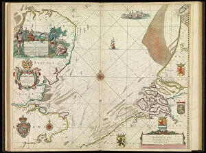
Background imageBelgium Collection: A chart of the sea coasts of England, Flanders and Holland, c.1672 (print)

A chart of the sea coasts of England, Flanders and Holland, c.1672 (print)
7340614 A chart of the sea coasts of England, Flanders and Holland, c.1672 (print) by Seller, John (1632-97); National Maritime Museum, London

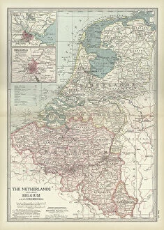
Background imageBelgium Collection: Map of Netherlands and Belgium, c.1900 (engraving)

Map of Netherlands and Belgium, c.1900 (engraving)
532956 Map of Netherlands and Belgium, c.1900 (engraving); (add.info.: Map showing the historical boundaries of Netherlands, Belgium, Luxemburg, with insets of Amsterdam and Brussels, circa 1902)

Background imageBelgium Collection: Map of Brussels, c.1900 (engraving)

Map of Brussels, c.1900 (engraving)
532721 Map of Brussels, c.1900 (engraving); (add.info.: Map of the city of Brussels, Belgium, circa 1900, from the 10th edition of Encyclopaedia Britannica.); Encyclopaedia Britannica/UIG

Background imageBelgium Collection: Battle of Waterloo, 18 June 1815 (litho)

Battle of Waterloo, 18 June 1815 (litho)
8652531 Battle of Waterloo, 18 June 1815 (litho) by Bartholomew, John George (1860-1920) ; Private Collection; (add.info.: Battle of Waterloo, 18 June 1815)

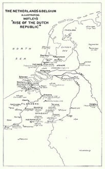
Background imageBelgium Collection: The Netherlands and Belgium, illustrating Motley's 'Rise of the Dutch Republic' (litho)

The Netherlands and Belgium, illustrating Motley's "Rise of the Dutch Republic" (litho)
8652512 The Netherlands and Belgium, illustrating Motley's "Rise of the Dutch Republic" (litho) by Bartholomew, John George (1860-1920) ; Private Collection; (add.info)

Background imageBelgium Collection: First World War: France, Patriotic Map showing four young children in Italian, English

First World War: France, Patriotic Map showing four young children in Italian, English
LUX4738404 First World War: France, Patriotic Map showing four young children in Italian, English, Belgian and Russian soldier uniforms around the French flag

Background imageBelgium Collection: First World War: France, Patriotic Map showing the five new nes of five allies under

First World War: France, Patriotic Map showing the five new nes of five allies under the protective leadership of
LUX4738234 First World War: France, Patriotic Map showing the five new nes of five allies under the protective leadership of France, entitled: For Law, for Liberty, Peace through Victory

Background imageBelgium Collection: First World War: Patriotic Map of Allied Soldiers Fighting the Enemy, 1915, Baker, Towards Victory

First World War: Patriotic Map of Allied Soldiers Fighting the Enemy, 1915, Baker, Towards Victory
LUX4744324 First World War: Patriotic Map of Allied Soldiers Fighting the Enemy, 1915, Baker, Towards Victory'; (add.info.: World War I - War 14-18 (1914-1918) - World War I (WWI or WW1)

Background imageBelgium Collection: First World War: Patriotic map showing the five flags of the allies with the commentary

First World War: Patriotic map showing the five flags of the allies with the commentary: They are also as many
LUX4744940 First World War: Patriotic map showing the five flags of the allies with the commentary: They are also as many, you will have to count with them

Background imageBelgium Collection: The colonial territories of North America claimed by the Dutch in 1764, on the Atlantic coast

The colonial territories of North America claimed by the Dutch in 1764, on the Atlantic coast
NWI4854329 The colonial territories of North America claimed by the Dutch in 1764, on the Atlantic coast, New Holland (or New Belgium) with the cities of Jamestown and Plymouth.; (add.info)

Background imageBelgium Collection: Map of the Netherlands and Belgium, around 1870 - Lithograph 19th century - Map of the Netherlands

Map of the Netherlands and Belgium, around 1870 - Lithograph 19th century - Map of the Netherlands and Belgium
NWI4872346 Map of the Netherlands and Belgium, around 1870 - Lithograph 19th century - Map of the Netherlands and Belgium, 1870s - Color lithograph; (add.info.: Map of the Netherlands and Belgium)

Background imageBelgium Collection: First World War: Patriotic map showing the five allied armed forces represented by children in

First World War: Patriotic map showing the five allied armed forces represented by children in uniform pose under an
LUX4744153 First World War: Patriotic map showing the five allied armed forces represented by children in uniform pose under an airship balloon called Alsace and entitled Victoire et Liberte

Background imageBelgium Collection: First World War: Patriotic map showing a French soldier and an English soldier consoling a Belgian

First World War: Patriotic map showing a French soldier and an English soldier consoling a Belgian soldier
LUX4743971 First World War: Patriotic map showing a French soldier and an English soldier consoling a Belgian soldier and titled Brother of Arms

Background imageBelgium Collection: Plan of the immense fortress town of Antwerp, Belgium, with a triple belt of forts (litho)

Plan of the immense fortress town of Antwerp, Belgium, with a triple belt of forts (litho)
3252885 Plan of the immense fortress town of Antwerp, Belgium, with a triple belt of forts (litho); Private Collection; (add.info.: Plan of the immense fortress town of Antwerp, Belgium)

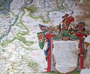
Background imageBelgium Collection: Cartouche with a dedication to Cardinal Richelieu (1585-1642)

Cartouche with a dedication to Cardinal Richelieu (1585-1642), and a map of the Low Countries at the time of the Thirty
CHT191867 Cartouche with a dedication to Cardinal Richelieu (1585-1642), and a map of the Low Countries at the time of the Thirty Years war (1618-48)

Background imageBelgium Collection: First World War: Patriotic Map showing five young women representing the Allied countries in their

First World War: Patriotic Map showing five young women representing the Allied countries in their symbolic dress
LUX4745083 First World War: Patriotic Map showing five young women representing the Allied countries in their symbolic dress, 1915

Background imageBelgium Collection: First World War: Patriotic map showing in a buccolic trench an English

First World War: Patriotic map showing in a buccolic trench an English and Belgian French soldier playing the map
LUX4744615 First World War: Patriotic map showing in a buccolic trench an English and Belgian French soldier playing the map between battles

Background imageBelgium Collection: First World War: Patriotic Map showing a French soldier rescuing a Belgian soldier during a battle

First World War: Patriotic Map showing a French soldier rescuing a Belgian soldier during a battle in a village, 1914
LUX4744522 First World War: Patriotic Map showing a French soldier rescuing a Belgian soldier during a battle in a village, 1914

Background imageBelgium Collection: First World War: Patriotic map showing a little boy and a little girl sends to their father at

First World War: Patriotic map showing a little boy and a little girl sends to their father at the forehead a wooden
LUX4744189 First World War: Patriotic map showing a little boy and a little girl sends to their father at the forehead a wooden crate with a card and kitten

Background imageBelgium Collection: The colonial territories of North America claimed by the Dutch in 1665, on the Atlantic coast

The colonial territories of North America claimed by the Dutch in 1665, on the Atlantic coast
NWI4853284 The colonial territories of North America claimed by the Dutch in 1665, on the Atlantic coast, New Holland (or New Belgium) including the states of New York, New Jersey, Delaware, Vermont

Background imageBelgium Collection: ORTELIUS, Abraham (1527-1598). Theatrum Orbis Terrarum. 1570

ORTELIUS, Abraham (1527-1598). Theatrum Orbis Terrarum. 1570. It is considered to be the first modern atlas
CUL4695089 ORTELIUS, Abraham (1527-1598). Theatrum Orbis Terrarum. 1570. It is considered to be the first modern atlas. CHAVES, Jeronimo de (1523-1574). Mathematic, astronomer and navigator

Background imageBelgium Collection: First World War: France, Patriotic Map showing four young children in Italian, English

First World War: France, Patriotic Map showing four young children in Italian, English
LUX4738398 First World War: France, Patriotic Map showing four young children in Italian, English, Belgian and Russian soldier uniforms around the French flag

Background imageBelgium Collection: First World War: France, Patriotic Map showing a caricature of Emperor William II in the form of a

First World War: France, Patriotic Map showing a caricature of Emperor William II in the form of a cow in a contest
LUX4739533 First World War: France, Patriotic Map showing a caricature of Emperor William II in the form of a cow in a contest entitled The Most Beautiful Cow in the World

Background imageBelgium Collection: First World War: France, Patriotic Map showing a French soldier

First World War: France, Patriotic Map showing a French soldier and a Belgian soldier shake hands before their
LUX4739518 First World War: France, Patriotic Map showing a French soldier and a Belgian soldier shake hands before their respective flag, titled: Valor Belge, Mercy

Background imageBelgium Collection: Map of the Waterloo Campaign, 1815. From The Story of England, published 1930

Map of the Waterloo Campaign, 1815. From The Story of England, published 1930
3058423 Map of the Waterloo Campaign, 1815. From The Story of England, published 1930.; Photo © Hilary Morgan

Background imageBelgium Collection: The french sails on River May, 1591 (engraving)

The french sails on River May, 1591 (engraving)
2435393 The french sails on River May, 1591 (engraving) by Bry, Theodor de (1528-98); (add.info.: History. USA. The french sails on River May (today Saint Johns River)

Background imageBelgium Collection: The War Map of Western Europe showings the entire zone of military operations in the Western

The War Map of Western Europe showings the entire zone of military operations in the Western campaign (litho)
3252857 The War Map of Western Europe showings the entire zone of military operations in the Western campaign (litho); Private Collection; (add.info.: The War Map of Western Europe)

Background imageBelgium Collection: Verucca, 1700

Verucca, 1700
2900907 Verucca, 1700; (add.info.: Verucca, 1700.); Buyenlarge Archive/UIG

Background imageBelgium Collection: Sir Thomas Octave Murdoch Sopwith (1888-1989) english pilot and aircraft manufacturer

Sir Thomas Octave Murdoch Sopwith (1888-1989) english pilot and aircraft manufacturer
1757296 Sir Thomas Octave Murdoch Sopwith (1888-1989) english pilot and aircraft manufacturer, in 1910 he won Forest prize for for the longest flight to the European continent

Background imageBelgium Collection: Plan by H.J. van Hutte for a new botanical garden for the centre of a park in Ghent, Belgium

Plan by H.J. van Hutte for a new botanical garden for the centre of a park in Ghent, Belgium. Chromolithograph by P
FLO4995494 Plan by H.J. van Hutte for a new botanical garden for the centre of a park in Ghent, Belgium. Chromolithograph by P

Background imageBelgium Collection: Map showing the area in the North Sea mined by the British during WWI

Map showing the area in the North Sea mined by the British during WWI, from The War Illustrated Album Deluxe, pub.1915
3502686 Map showing the area in the North Sea mined by the British during WWI, from The War Illustrated Album Deluxe, pub.1915; (add.info)

Background imageBelgium Collection: Plan of the immense fortress town of Antwerp, Belgium (litho)

Plan of the immense fortress town of Antwerp, Belgium (litho)
3252881 Plan of the immense fortress town of Antwerp, Belgium (litho); Private Collection; (add.info.: Plan of the immense fortress town of Antwerp, Belgium)

Background imageBelgium Collection: First World War: France, Patriotic Map showing four young girls symbolically dressed in uniforms

First World War: France, Patriotic Map showing four young girls symbolically dressed in uniforms of the French
LUX4737808 First World War: France, Patriotic Map showing four young girls symbolically dressed in uniforms of the French, Italian, English and Belgian armed forces pose with their flag

Background imageBelgium Collection: First World War: France, Patriotic Map showing a Belgian soldier

First World War: France, Patriotic Map showing a Belgian soldier and a French soldier with their flag swearing fidelity
LUX4737752 First World War: France, Patriotic Map showing a Belgian soldier and a French soldier with their flag swearing fidelity with the following sentence

Background imageBelgium Collection: First World War: France, An infant in his cradle protects by the flags of the allies

First World War: France, An infant in his cradle protects by the flags of the allies
LUX4738094 First World War: France, An infant in his cradle protects by the flags of the allies, patriotic map entitled Child of War

Background imageBelgium Collection: First World War: France, Patriotic Map showing a facsimile of the paper cloth

First World War: France, Patriotic Map showing a facsimile of the paper cloth
LUX4739851 First World War: France, Patriotic Map showing a facsimile of the paper cloth (non-respect of the Germans for Belgian neutrality) with a patriotic commentary by Rene des Alyscanps

Background imageBelgium Collection: First World War: France, Patriotic Map showing 5 young women representing the 5 countries of

First World War: France, Patriotic Map showing 5 young women representing the 5 countries of the alliance: France
LUX4739512 First World War: France, Patriotic Map showing 5 young women representing the 5 countries of the alliance: France, Russia, Italy, Belgium and England

Background imageBelgium Collection: First World War: France, Patriotic Map showing Germany asking Belgium to let her pass

First World War: France, Patriotic Map showing Germany asking Belgium to let her pass and return home, 1917
LUX4739448 First World War: France, Patriotic Map showing Germany asking Belgium to let her pass and return home, 1917, Return from France'; (add.info)

Background imageBelgium Collection: First World War: Patriotic Map showing a French soldier, an English soldier

First World War: Patriotic Map showing a French soldier, an English soldier
LUX4744803 First World War: Patriotic Map showing a French soldier, an English soldier and a Belgian soldier having fun reading the soldiers letters and entitled Dans les trchees

Background imageBelgium Collection: First World War: Patriotic map showing a Belgian soldier in uniform declaring with his Belgian

First World War: Patriotic map showing a Belgian soldier in uniform declaring with his Belgian expressions
LUX4745265 First World War: Patriotic map showing a Belgian soldier in uniform declaring with his Belgian expressions: I send you a good kiss, for once know you

Background imageBelgium Collection: Patriotic map showing in a dream trench a Belgian soldier plays an accordeon air in front of

Patriotic map showing in a dream trench a Belgian soldier plays an accordeon air in front of cheerful French
LUX4743619 Patriotic map showing in a dream trench a Belgian soldier plays an accordeon air in front of cheerful French and English soldiers

Background imageBelgium Collection: First World War: Patriotic map showing a Belgian soldier and a French soldier repelling

First World War: Patriotic map showing a Belgian soldier and a French soldier repelling the Prussians in the Marne
LUX4743991 First World War: Patriotic map showing a Belgian soldier and a French soldier repelling the Prussians in the Marne and entitled Les Prussiens sont dans la Marne, 1914

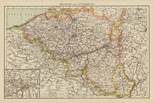
Background imageBelgium Collection: Belgium and Luxemburg (colour litho)

Belgium and Luxemburg (colour litho)
8653599 Belgium and Luxemburg (colour litho) by English School, (19th century); Private Collection; (add.info.: Belgium and Luxemburg)

Background imageBelgium Collection: BRAUN, George (1541-1622). ORTELIUS, Abraham (1527-1598). HOGENBERG, Franz (1535-1590)

BRAUN, George (1541-1622). ORTELIUS, Abraham (1527-1598). HOGENBERG, Franz (1535-1590)
CUL4853258 BRAUN, George (1541-1622). ORTELIUS, Abraham (1527-1598). HOGENBERG, Franz (1535-1590). Civitatis Orbis Terrarum (Theatrum orbis terrarum). 1572-1617. Cover of the volume I. Etching


All Professionally Made to Order for Quick Shipping


-

Belgium Collection

Belgium is a small country located in Western Europe, bordered by France, Germany, Luxembourg and the Netherlands and has a population of approximately 11 million people and covers an area of 30,528 square kilometers. The capital city is Brussels which also serves as the headquarters for the European Union. Belgium is known for its chocolate, beer and waffles but it's also home to several important institutions such as NATO and the European Parliament. Its economy relies heavily on exports with major industries including chemicals, machinery and equipment manufacturing. The country has three official languages: Dutch (Flemish), French and German with each region having its own distinct culture.
+

Our beautiful Wall Art and Photo Gifts include Framed Prints, Photo Prints, Poster Prints, Canvas Prints, Jigsaw Puzzles, Metal Prints and so much more

The Belgium collection from Media Storehouse is a stunning array of wall art and framed prints that showcase the beauty, history, and culture of this European country. Our collection features an extensive range of maps and charts that highlight the geography, topography, landmarks, cities, towns, rivers, lakes, forests, mountains and other natural wonders of Belgium. These high-quality prints are perfect for anyone who loves to explore new places or has a fascination with cartography. Our collection also includes vintage posters that depict iconic Belgian landmarks such as the Atomium in Brussels or the medieval city of Bruges. These posters offer a glimpse into the past while capturing the timeless charm of these popular tourist destinations. Whether you're looking to decorate your home or office space with beautiful artwork inspired by Belgium's rich cultural heritage or simply want to add some unique pieces to your art collection - our Belgium collection has something for everyone.
+

What are Belgium (Maps and Charts) art prints?

Belgium art prints are a collection of high-quality reproductions of antique maps and charts that depict the geography, topography, and history of Belgium. These prints showcase the intricate details and artistic styles used in creating these historical documents, making them perfect for collectors or anyone interested in Belgian history. The collection includes various types of maps such as political maps, physical maps, road maps, city plans, railway networks as well as nautical charts. The artwork is printed on premium quality paper using advanced printing techniques to ensure that every detail is captured with precision. These art prints serve not only as decorative pieces but also as educational resources for students studying geography or history. They can be framed or mounted to create an eye-catching display in homes or offices. Belgium art prints offer a unique way to explore the rich cultural heritage of this European country through stunning visual representations that have stood the test of time.
+

What Belgium (Maps and Charts) art prints can I buy from Media Storehouse?

We offer a wide range of Belgium maps and charts art prints that you can purchase. These art prints are perfect for those who love to travel or have an interest in geography. The collection includes antique maps, city plans, topographical maps, and more. One popular option is the vintage map of Brussels from 1905 which showcases the layout of the city during that time period. Another great choice is the detailed topographical map of Belgium which highlights its diverse landscape including forests, rivers, and mountains. For those interested in history, Media Storehouse also offers a selection of World War I battlefield maps depicting key locations such as Ypres and Passchendaele. All art prints are available in various sizes to suit your needs and come on high-quality paper or canvas material. With so many options to choose from, there's sure to be a Belgium map or chart print that will fit perfectly into your home decor.
+

How do I buy Belgium (Maps and Charts) art prints?

To buy Belgium art prints from Media Storehouse, you can browse our extensive collection of high-quality images online. Simply search for "Belgium Maps and Charts" in the search bar on our website to find a range of options. Once you have found the print that you like, select your preferred size and framing option if available, add it to your cart, and proceed to checkout. We offer a variety of payment methods including credit card, PayPal or Amazon Pay. We also offer worldwide shipping with various delivery options available depending on your location. Their prints are produced using high-quality printing techniques ensuring that each print is vibrant and long-lasting. Whether you're looking for a vintage map or contemporary chart design, we have something for everyone. Buying Belgium art prints from Media Storehouse is an easy process that allows you to bring beautiful artwork into your home or office space.
+

How much do Belgium (Maps and Charts) art prints cost?

Belgium art prints are available for purchase at Media Storehouse. The cost of these prints varies depending on the size, material, and framing options selected by the customer. However, you can be assured that they will receive high-quality prints that showcase the beauty of Belgium's maps and charts. We offer a wide range of print sizes to choose from, allowing customers to find the perfect fit for their space. Additionally, there are various materials to select from such as canvas or paper which can affect pricing. Customers also have the option to add frames or mountings if desired. We provide an affordable way for individuals to own beautiful pieces of artwork featuring Belgium's maps and charts without breaking their budget. With so many options available at different price points, anyone can find something they love within their budget range.
+

How will my Belgium (Maps and Charts) art prints be delivered to me?

Your Belgium art prints will be delivered to you in a safe and secure manner. We take great care in packaging your artwork so that it arrives at your doorstep undamaged. Your prints will be carefully rolled up and placed inside a sturdy tube, which is then sealed with protective caps on both ends. This ensures that your artwork stays flat during transit and prevents any creases or bends from occurring. We work with trusted shipping partners who provide reliable delivery services worldwide. Depending on your location, we offer various delivery options to suit your needs, including standard shipping or express delivery for urgent orders. Once your order has been dispatched, you will receive an email notification containing tracking information so that you can monitor the progress of your shipment. If you have any questions about the delivery of your Belgium art prints, please don't hesitate to contact our friendly customer service team who are always happy to help.