Home > Historic > Ancient civilizations > Mesopotamia > Babylonian empire
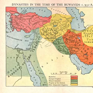
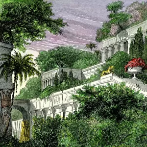
Map showing the relation of the Median and second Babylonian (Chaldaean) Empires, 1936
 Empires, 1936")
![]()
Wall Art and Photo Gifts from Fine Art Finder
Map showing the relation of the Median and second Babylonian (Chaldaean) Empires, 1936
7125140 Map showing the relation of the Median and second Babylonian (Chaldaean) Empires, 1936; (add.info.: Map showing the relation of the Median and second Babylonian (Chaldaean) Empires. From A Short History of the World, published c.1936); Photo © Ken Welsh. All rights reserved 2024
Media ID 38432928
© © Ken Welsh. All rights reserved 2024 / Bridgeman Images
Ageing Babylon Babylonian Babylonians Imperials Iraq Iraq Iraqi Mesopotamia Relation Relationship Relationships Run Down Arab Civilization Arab Culture Arabians Geographer
FEATURES IN THESE COLLECTIONS
> Arts
> Artists
> B
> Babylonian Babylonian
> Asia
> Iraq
> Related Images
> Fine Art Finder
> Artists
> Duncan McGregor Whyte
> Historic
> Ancient civilizations
> Babylonian Empire
> Historic
> Ancient civilizations
> Mesopotamia
> Babylonian empire
> Historic
> Ancient civilizations
> Mesopotamia
> Historic
> Ancient civilizations
> Maps and Charts
> Early Maps
> Maps and Charts
> Related Images
> Maps and Charts
> World
EDITORS COMMENTS
This vintage print showcases a map depicting the relationship between the Median and second Babylonian (Chaldaean) Empires in 1936. The intricate details of this historical cartography highlight the ancient civilizations of Mesopotamia, specifically focusing on Babylon and its surrounding regions. The aged appearance of the map adds to its charm, giving viewers a glimpse into the past and allowing them to appreciate the rich history of this area.
The Babylonians were known for their advanced culture and imperial power, influencing much of the Middle East during their reign. This map serves as a reminder of their dominance in antiquity and their lasting impact on Arab civilization. The engravings on this piece are a testament to the skilled geographers who meticulously documented these empires for future generations to study.
As we gaze upon this relic from 1936, we are transported back in time to an era where empires rose and fell, leaving behind traces of their existence etched onto maps like these. It is through artifacts such as this that we can better understand our shared history and appreciate the complexities of human relationships throughout different periods in time.
MADE IN THE USA
Safe Shipping with 30 Day Money Back Guarantee
FREE PERSONALISATION*
We are proud to offer a range of customisation features including Personalised Captions, Color Filters and Picture Zoom Tools
SECURE PAYMENTS
We happily accept a wide range of payment options so you can pay for the things you need in the way that is most convenient for you
* Options may vary by product and licensing agreement. Zoomed Pictures can be adjusted in the Cart.